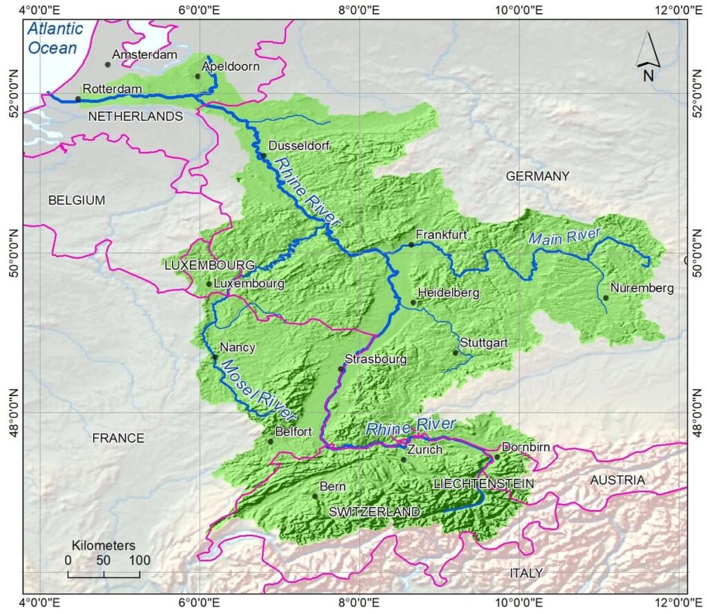
The Rhine River is one of the major rivers of
Europe. This river is the second-longest river in Central and Western Europe. The total length of the Rhine River is 1230 km (760 miles) and its average water discharge is about 2,900 m
3/s (100,000 cu ft./s). The average discharge of the Rhine River is 2,900 m
3/s (100,000 cu ft./s), which ranges minimum of 800 m
3/s (28,000 cu ft./s) and the maximum 13,000 m
3/s (460,000 cu ft./s)
The Rhine River map shows that this river originates in the southeastern
Swiss Alps of
Switzerland. After flowing south to the north, this river flows along the German-Swiss border from the east to the west. Then, this river flows along the French-German border from the south to the north direction. This
river turns toward the northwest when it reaches the west of
Heidelberg in
Germany. It turns to the westward, and, enters into the
Netherlands, and finally drains into the
Atlantic Ocean.

Tributaries of Rhine river
Rhine river maps shows the major tributaries only. The major tributaries of the Rhine are the Main and Mosel rivers. The Maine River is in Germany and the Mosel River originates in
France and joins the Rhine River in Germany. There are many tributaries, which feed the Rhine River. At the beginning, the Rhine River is known as the Alpine Rhine.
Rhine river basin
Green colored areas on the Rhine river map are the Rhine river basin. The total area of the Rhine River basin is 185,000 km
2 (71,000 sq. mi). Most of the basin area of the river is in Germany, France, and Switzerland.
Austria,
Luxembourg,
Belgium, and the Netherlands also share some parts of the basin area.
Nearly 61% of the total area of the Rhine River basin falls in Germany followed by 16% in Switzerland and 15% in France. More than 92% of the area of the basin is in these three countries. The Netherlands shares nearly 5% of the total area, 2% in Luxemburg, and the remaining areas are in Austria, Belgium,
and
Liechtenstein.


